Project Lead: Lyndsey Dowell
Project Type: Graduate Thesis
Supervisor: Dr. Sean Smukler
Funders: British Columbia Ministry of Agriculture, Natural Sciences and Engineering Research Council of Canada (NSERC)
Overview
Non-production vegetation plays an increasingly important role in achieving long-term, sustainable food production in areas with intensive agricultural land use, such as the Lower Fraser Valley region of British Columbia. Integrating non-production vegetation into agricultural landscapes in the form of hedgerows and riparian buffers is considered a beneficial management practice (BMP) because of the myriad localized and regional ecosystem system services it provides. These services include storing carbon, increasing biodiversity, trapping pollutants, and mitigating erosion. However, the magnitude of these services, which depends on the characteristics and placement of individual hedgerows and riparian buffers, at a landscape level is unknown.
An up-to-date map of hedgerows and riparian buffers and an indication of each BMP’s ecosystem service provisioning will illustrate how much this practice is contributing to agricultural land in the Lower Fraser Valley. Semi-automated detection from satellite imagery and a remotely measurable indicator of ecosystem services offer efficient, affordable, and repeatable alternatives to manual mapping and data collection. Successful methods for mapping and modelling of ecosystem services will lead to more informed BMP integration programs and allow changes in efficacy to be measured over time.
Research Questions
The main goal of this study is to improve methodologies for mapping and quantifying changes to hedgerows and riparian buffers on agricultural landscapes located in the Lower Fraser Valley of British Columbia, focusing on coverage and carbon storage.
This project’s specific research questions are:
- Which characteristics are most indicative of the amount of carbon hedgerows and riparian buffers store?
- How much does above and below ground carbon storage change over a five-year period in newly planted and matured hedgerow types?
- Can remote-sensing methods using RapidEye satellite imagery accurately detect hedgerows and riparian buffers? Can these methods accurately detect changes over time?
- What is the current abundance and distribution of hedgerows and riparian buffers? Has this changed over the last 10 years?
- Can remote-sensing methods using RapidEye satellite imagery accurately predict above and below ground carbon? Can these methods be employed to accurately detect changes to above and below ground carbon over time?
Expected Outcomes
This research will produce above and below ground carbon maps of hedgerows and riparian buffers in the Lower Fraser Valley for 2009, 2013, and 2017. These maps will be made freely available for public use.
Preliminary Results
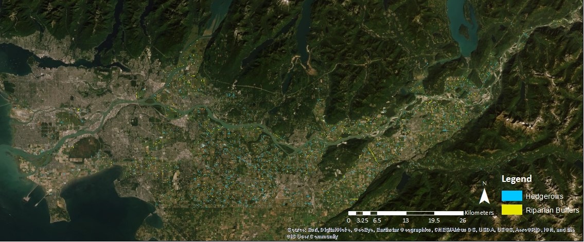
Hedgerow and Riparian Buffer Maps for 2017 – Lower Fraser Valley
- To download the hedgerow and riparian buffer layer in .zip format – CLICK
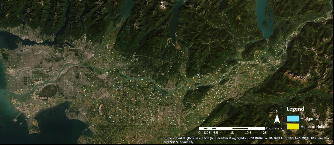
Hedgerow and Riparian Buffer Maps for 2013 – Lower Fraser Valley
- To download the hedgerow and riparian buffer layer in .zip format – CLICK
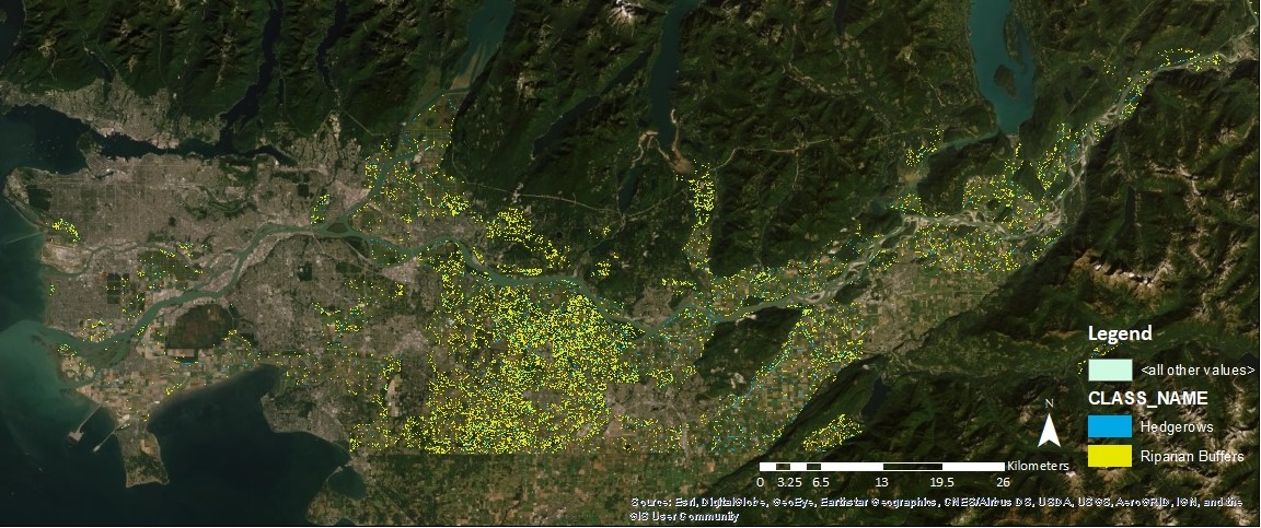
Hedgerow and Riparian Buffer Maps for 2009 – Lower Fraser Valley
- To download the hedgerow and riparian buffer layer in .zip format – CLICK
Accuracy Metrics for All Maps – indicate shape, theme, and position similarity to reference data (Lizarazo, 2014))
| 2017 | 2013 | 2009 | ||||
| Hedgerows | Riparian Buffers | Hedgerows | Riparian Buffers | Hedgerows | Riparian Buffers | |
| Shape | 0.71 | 0.71 |
0.72 |
0.70 |
0.64 | 0.69 |
| Theme | 0.25 | 0.10 | 0.23 |
0.15 |
0.21 | 0.13 |
| Position | 0.99 | 0.99 | 0.99 | 0.99 | 0.99 | 0.99 |
Participants
The following undergraduate students have been assisting with this research:
- Amit Chandna
- Dylan Peluso
- Elli Newman
- Mariana Berlanga
- Paul Yeung
- Pauline Ng