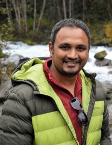
Graduate Student –  PhD in Soil Science
Email: siddpaul(at)mail.ubc.ca | siddhartho.paul(at)gmail.com
Website: https://www.sspaul.com/
GoogleScholar ResearchGate Twitter Linkedin
Education
- MSc – Natural Resources & Environmental Science, University of Northern British Columbia (2013)
- MSc – Hydrogeology & Environmental Geology, University of Dhaka (2010)
- BSc – Geology, University of Dhaka (2008)
Research Interests
- Remote sensing and Geospatial analysis
- Digital soil mapping
- Land use – land cover change
- Climate change adaptation & mitigation
I am an Environmental Geoscientist who uses remote sensing and spatial data to understand how anthropogenic modifications of the natural landscape impact various ecosystem services. Specifically, I am interested in studying the effects of land use – land cover change and climate change on soil organic carbon stock, soil hydrology, surface water, and groundwater resources.
Current Research
Project-1: Delta drainage project
Delta is one of the most productive agricultural areas of British Columbia. However, it’s fine textured soil and proximity to the ocean create challenges for drainage and salinity management. Changing precipitation patterns triggered by climate change may further compound these challenges. Delta drainage project looked at various aspects of the drainage issues in Delta and endeavored to provide effective management options to the producers. My role in this project was to 1) develop digital maps of various soil properties at field and landscape scales using remote sensing tools to understand the impacts of existing agricultural management practices on drainage, soil workability, and soil salinity, 2) estimate number of workable days at various drainage treatments under projected future climate scenarios using DRAINMOD model.
For more detail: Project page
Maps produced: Landscape-scale digital map of Soil Organic Carbon (%) and Soil Workability
Project-2: Spatiotemporal Analysis of Land Use Land Cover and Soil Organic Carbon in the Agricultural Landscape of the Lower Fraser Valley
Soil organic carbon (SOC), the largest terrestrial pool of organic carbon is critical for climate change mitigation and adaptation as well as for ensuring the sustainability of agricultural production. Intensive agricultural land use practices often result in a severe decline in SOC. Lower Fraser Valley (LFV), one of the most productive agricultural regions of British Columbia has been predicted with the risk of degradation of SOC. Although intensive agricultural production and land use land cover (LULC) changes are the major drivers of SOC loss, incorporating sustainable LULC practices, like grassland rotations, cover cropping, hedgerows, riparian buffers and other beneficial management practices (BMPs) can reduce or even reverse these trends. Therefore, the objective of this project is to understand the spatiotemporal changes in SOC under various LULC practices in LFV. The project will combine time-series satellite images, projected climate data, and soil data to predict historical, current and future SOC stock in the agricultural landscape of LFV.
For more detail: Project page
Maps produced (preliminary): LULC maps from 1984 to 2018 | SOC maps from 1984 to 2018
Current Awards and Scholarships
- Mitacs Accelerate Scholarship (2016-2019)
- Microsoft AI for Earth Award (2018-2019)
- Faculty of Land & Food System Graduate Excellence Award (2015-2018)
Read my Tweets
Tweets by SiddS_Paul